May 07, 2018
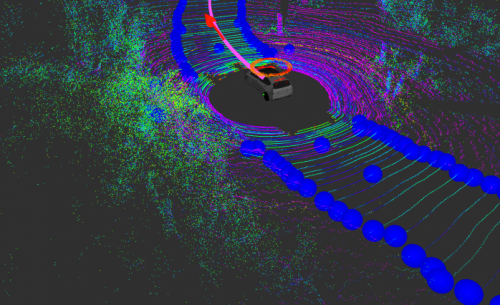
Today’s autonomous vehicles require hand-labeled 3-D maps, but CSAIL’s MapLite system enables navigation with just GPS and sensors. MapLite uses perception sensors to plan a safe path, including LIDAR to determine the approximate location of the edges of the road.
Full story at URL.